Trail Walking Le Lauzet-Ubaye - Petit circuit de Roche Rousse Tunnels et passerelle.  - Photo

Petit circuit de Roche Rousse Tunnels et passerelle.

© OpenStreetMap contributors
Length
Length
8.3 km
Max alt
Max alt
1044 m
Uphill gradient
Uphill gradient
371 m
Km-Effort
Km-Effort  
13.3 km
Min alt
Min alt
794 m
Downhill gradient
Downhill gradient
376 m
Boucle
Boucle
Yes
Creation date :
2020-03-15 13:54:22.319
Updated on :
2020-03-15 18:50:35.339

(0 Reviews)

Walking
Walking
2h09
Difficulty : Medium

Scan this QR Code to open this trail in the SityTrail application

FREE GPS app for hiking

Logo SityTrail SityTrail

IGN / Geographical institutes

Download SityTrail from the App Store Download SityTrail from Google Play

Logo SityTrail SityTrail World

The world is yours!

Download SityTrail from the App Store Download SityTrail from Google Play Download SityTrail on Huawei AppGallery

About

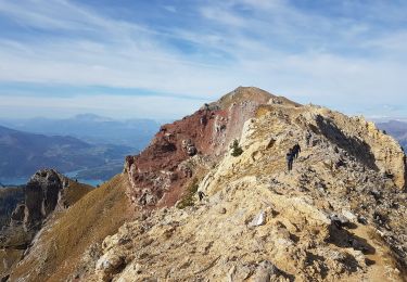
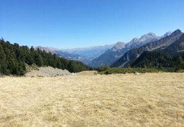
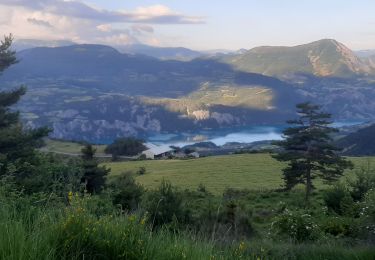
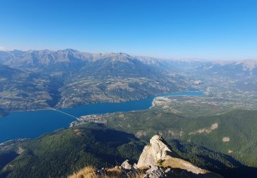
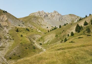
Trail Walking of 8.3 km to be discovered at Provence-Alpes-Côte d'Azur, Alpes-de-Haute-Provence, Le Lauzet-Ubaye. This trail is proposed by Dervalmarc.

Description

Très beau circuit très varié.
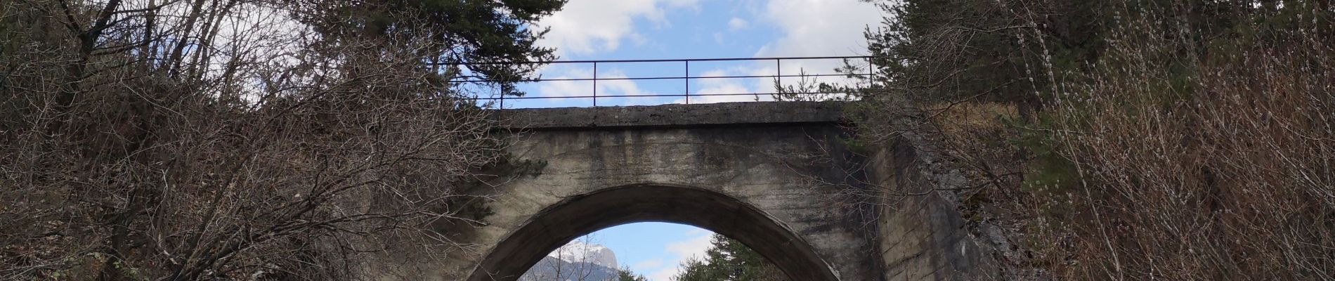
Hameaux abandonnés. Passerelle himalayenne. Vallon et forêt sauvage.
Attention à la traversée de la ravine de Roche Rousse.
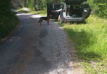
Ne pas stationé.
Risque déboulement.

Elevation profile

Photos

Positioning

Country:
France
Region :
Provence-Alpes-Côte d'Azur
Department/Province :
Alpes-de-Haute-Provence
Municipality :
Le Lauzet-Ubaye
Location:
Unknown
Start:(UTM)
291872 ; 4925982 (32T) N.

Trails nearby

Trail Walking Crots - Le Cirque de Morgon - Photo
Walking
tracegps

Walking

Difficult
(5)
Crots, Provence-Alpes-Côte d'Azur, Hautes-Alpes, France
10.6 km | 21 km-effort
5h 30min
Yes
Trail Walking Ubaye-Serre-Ponçon - MONTCLAR , les Rollands  , canal de la Pisse , Pre Balou , fontaine du loup , fontaine de l mane o l m s - Photo
Walking
RobinMicheline

Walking

Medium
(1)
Ubaye-Serre-Ponçon, Provence-Alpes-Côte d'Azur, Alpes-de-Haute-Provence, France
15.6 km | 23 km-effort
4h 22min
Yes
Trail Walking Crots - Morgon par le Grand Clot - Photo
Walking
GUIDE
David25400

Walking

Easy
(1)
Crots, Provence-Alpes-Côte d'Azur, Hautes-Alpes, France
11.8 km | 22 km-effort
5h 49min
Yes
Trail Walking Le Lauzet-Ubaye - lac noir (col du bas) - Photo
Walking
gildascb

Walking

Easy
(1)
Le Lauzet-Ubaye, Provence-Alpes-Côte d'Azur, Alpes-de-Haute-Provence, France
11.9 km | 22 km-effort
4h 29min
Yes
Trail Walking Le Lauzet-Ubaye - lac du milieu - Photo
Walking
GebleuxGaetan

Walking

Easy
(2)
Le Lauzet-Ubaye, Provence-Alpes-Côte d'Azur, Alpes-de-Haute-Provence, France
8.2 km | 15.6 km-effort
2h 53min
Yes
Trail Walking Pontis - PONTIS , le dolmen  - Photo
Walking
RobinMicheline

Walking

Medium
(1)
Pontis, Provence-Alpes-Côte d'Azur, Alpes-de-Haute-Provence, France
12.9 km | 21 km-effort
3h 50min
Yes
Trail Walking Pontis - Le Grand Morgon par la face nord 07/09/23 - Photo
Walking
GUIDE
R@ph

Walking

Difficult
Pontis, Provence-Alpes-Côte d'Azur, Alpes-de-Haute-Provence, France
7.8 km | 18.9 km-effort
4h 18min
Yes
Trail Walking Le Lauzet-Ubaye - Trou du Duc  - Photo
Walking
GUIDE
David25400

Walking

Medium
Le Lauzet-Ubaye, Provence-Alpes-Côte d'Azur, Alpes-de-Haute-Provence, France
14 km | 29 km-effort
6h 44min
Yes
Trail Walking Le Lauzet-Ubaye - Trou du Duc - Photo
Walking
GUIDE
David25400

Walking

Medium
Le Lauzet-Ubaye, Provence-Alpes-Côte d'Azur, Alpes-de-Haute-Provence, France
14 km | 29 km-effort
7h 19min
Yes


Close
My subscriptions